Geographical Information Systems | Spatial Analysis, Raster, and Dot Density Maps
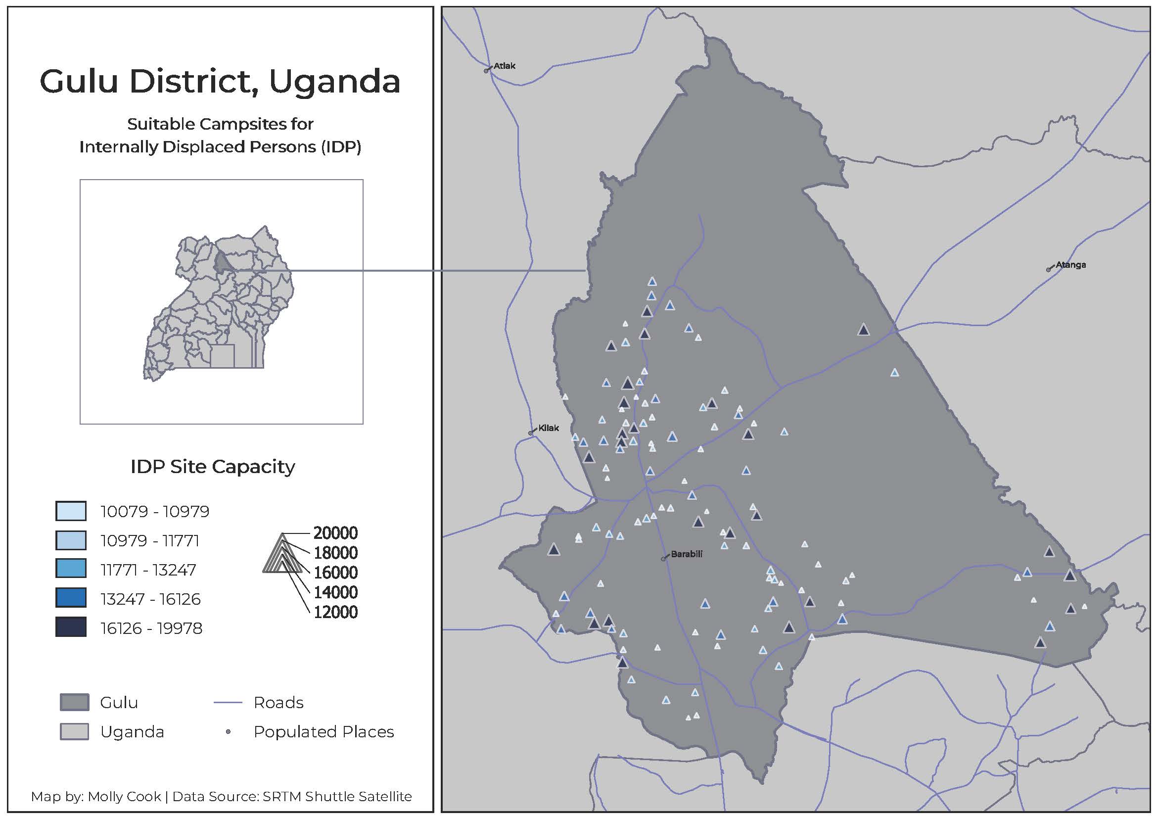
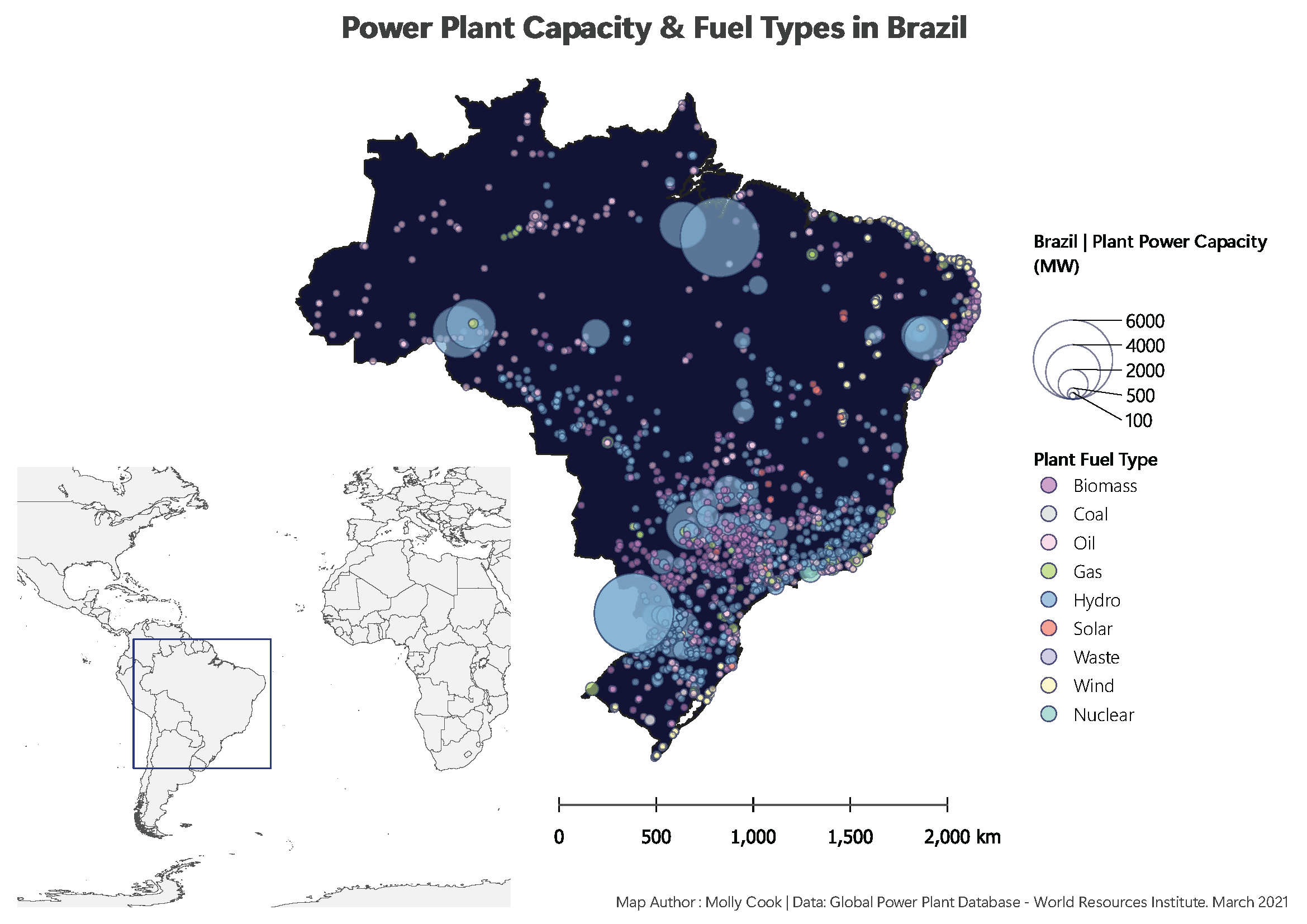
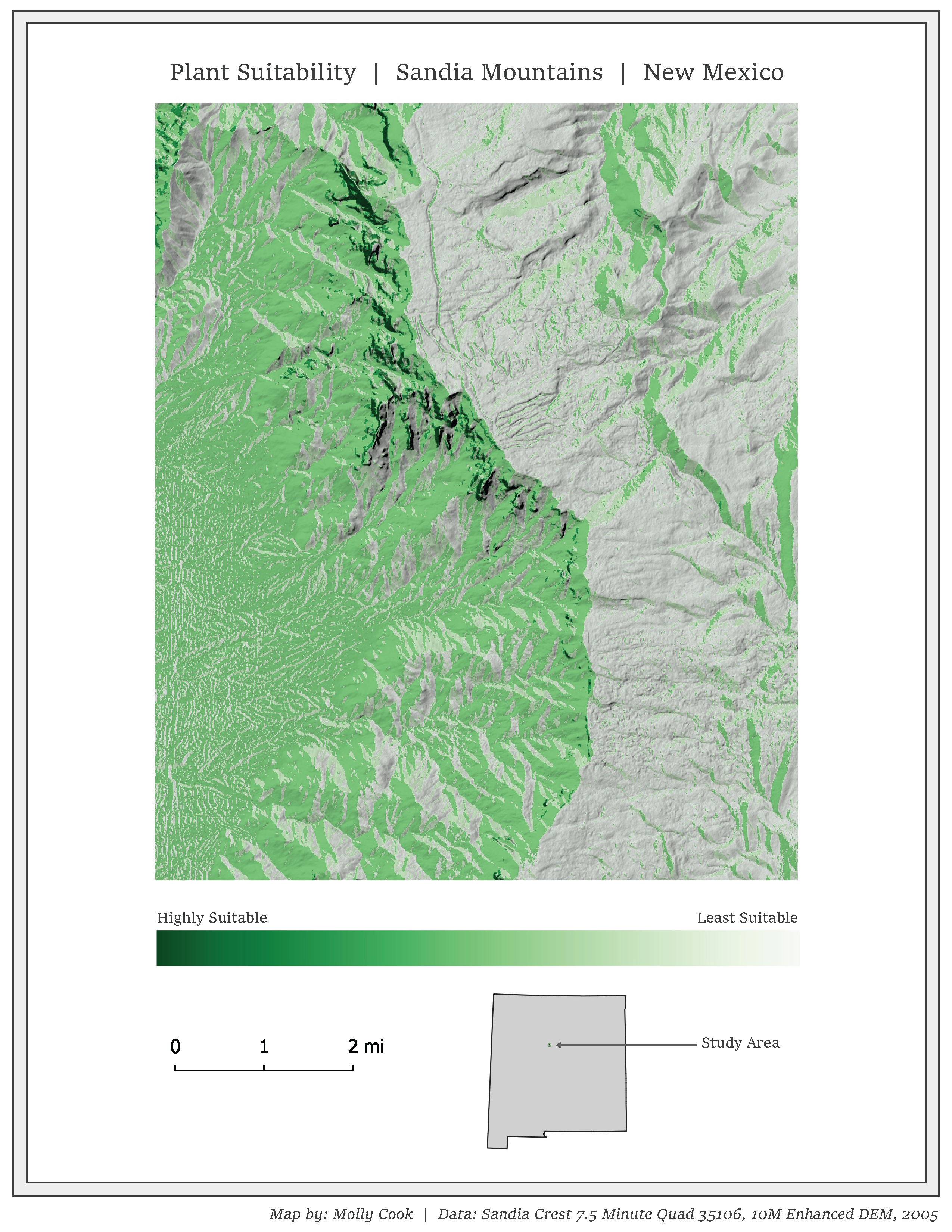
This collection showcases a range of projects completed using QGIS, encompassing tasks such as mapping power plants in Brazil and assessing plant suitability in the Sandia Mountains, New Mexico. The projects also include raster and vector analysis, particularly in determining suitability for IDP (Internally Displaced Persons) camp sites in Gulu, Uganda, and assessing plant suitability in the Sandia Mountains, New Mexico.
What I Used
- QGIS
- Data Source: annotated within each document