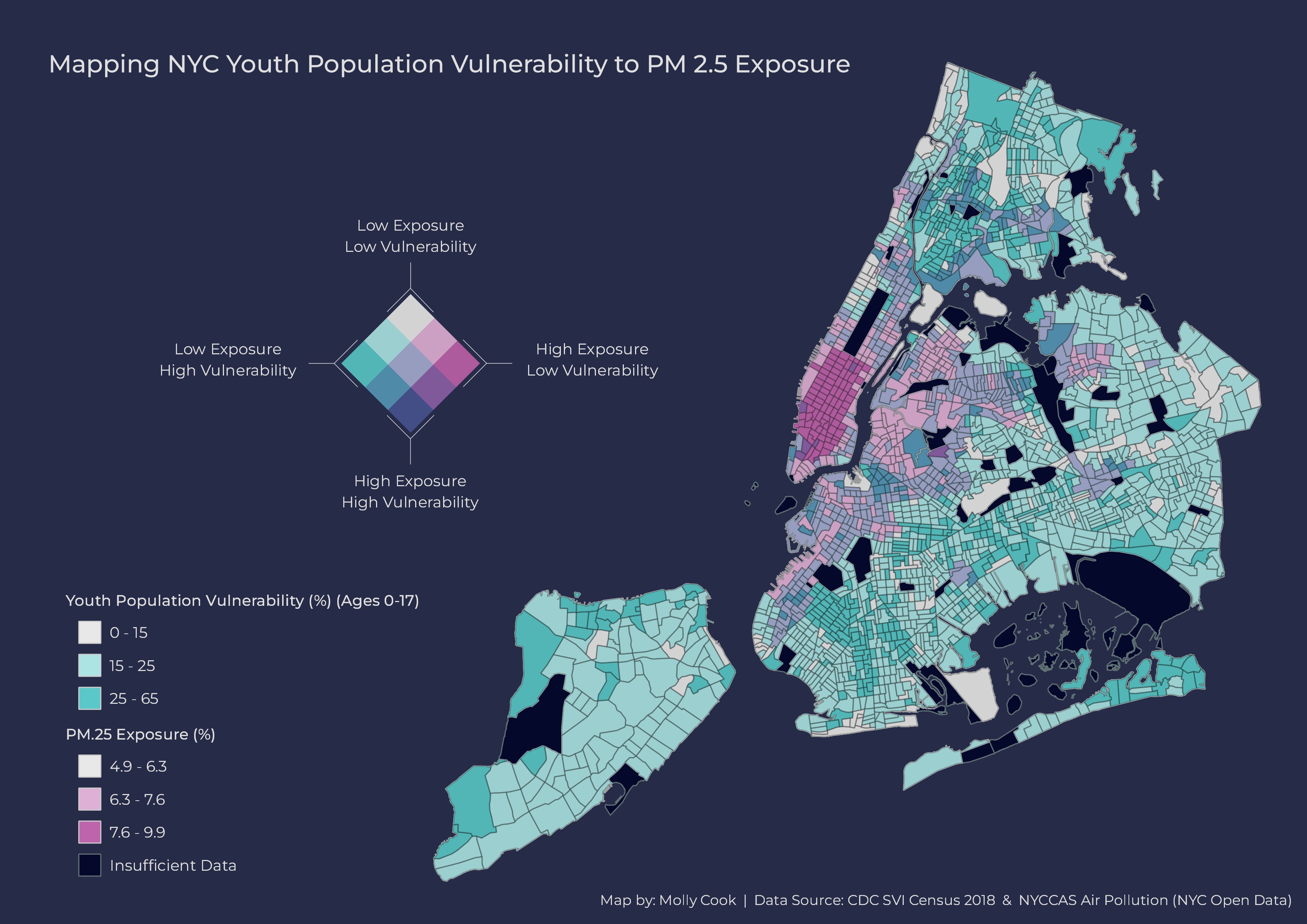
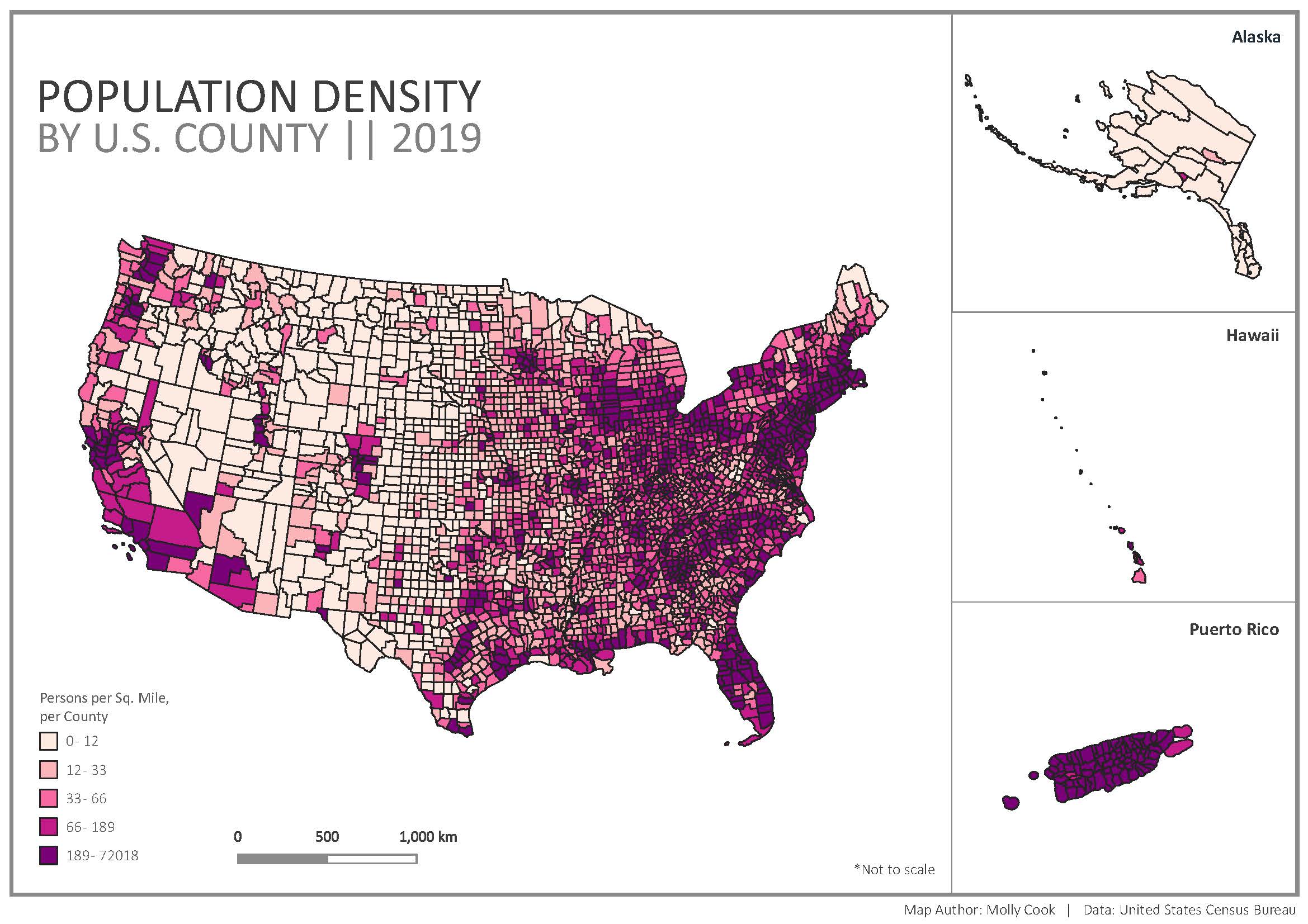
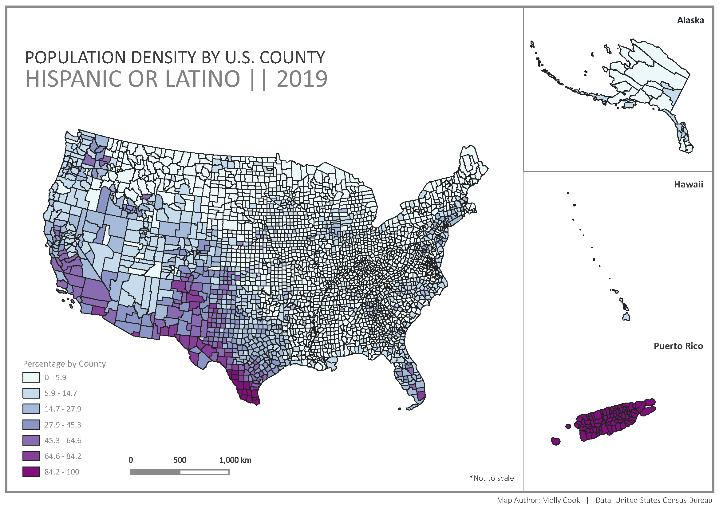
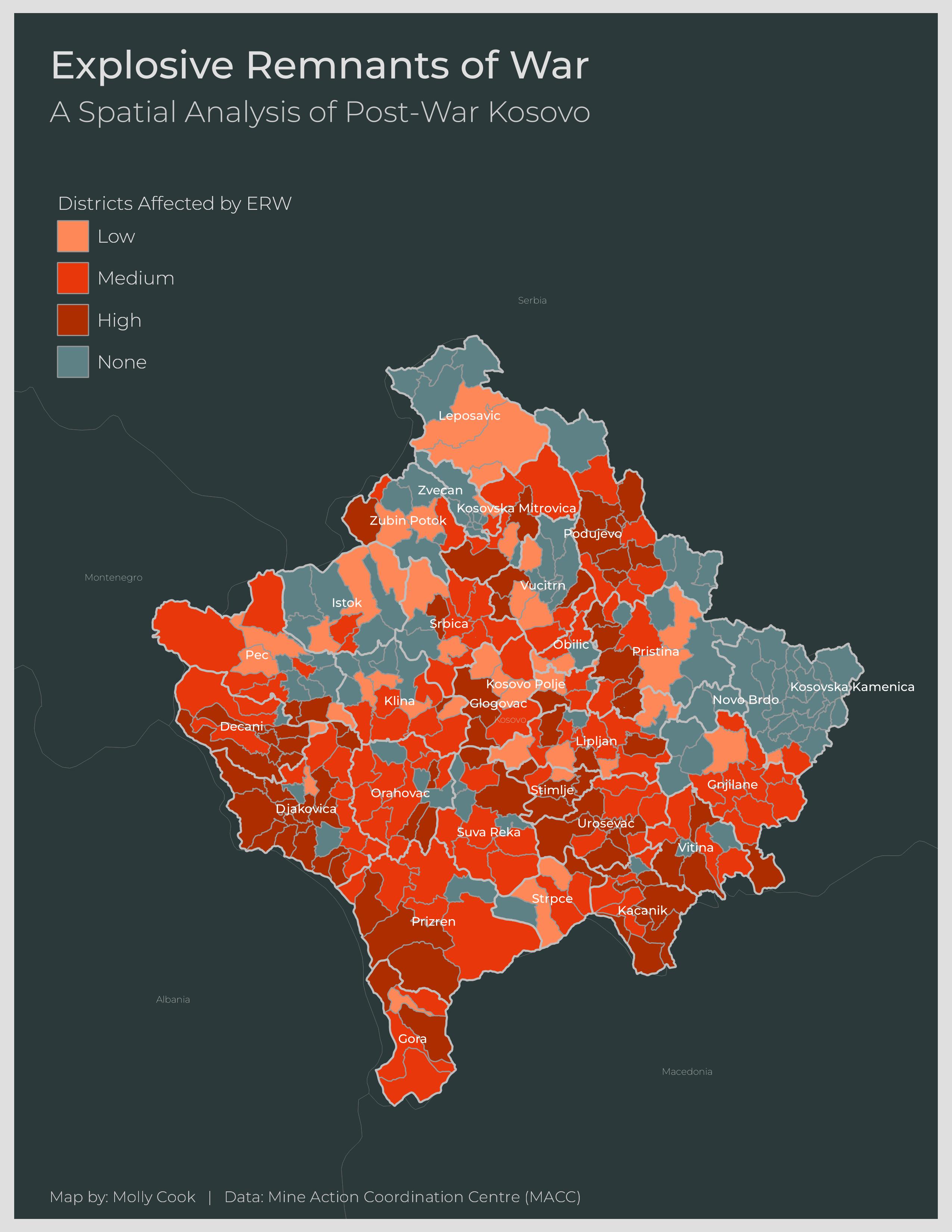
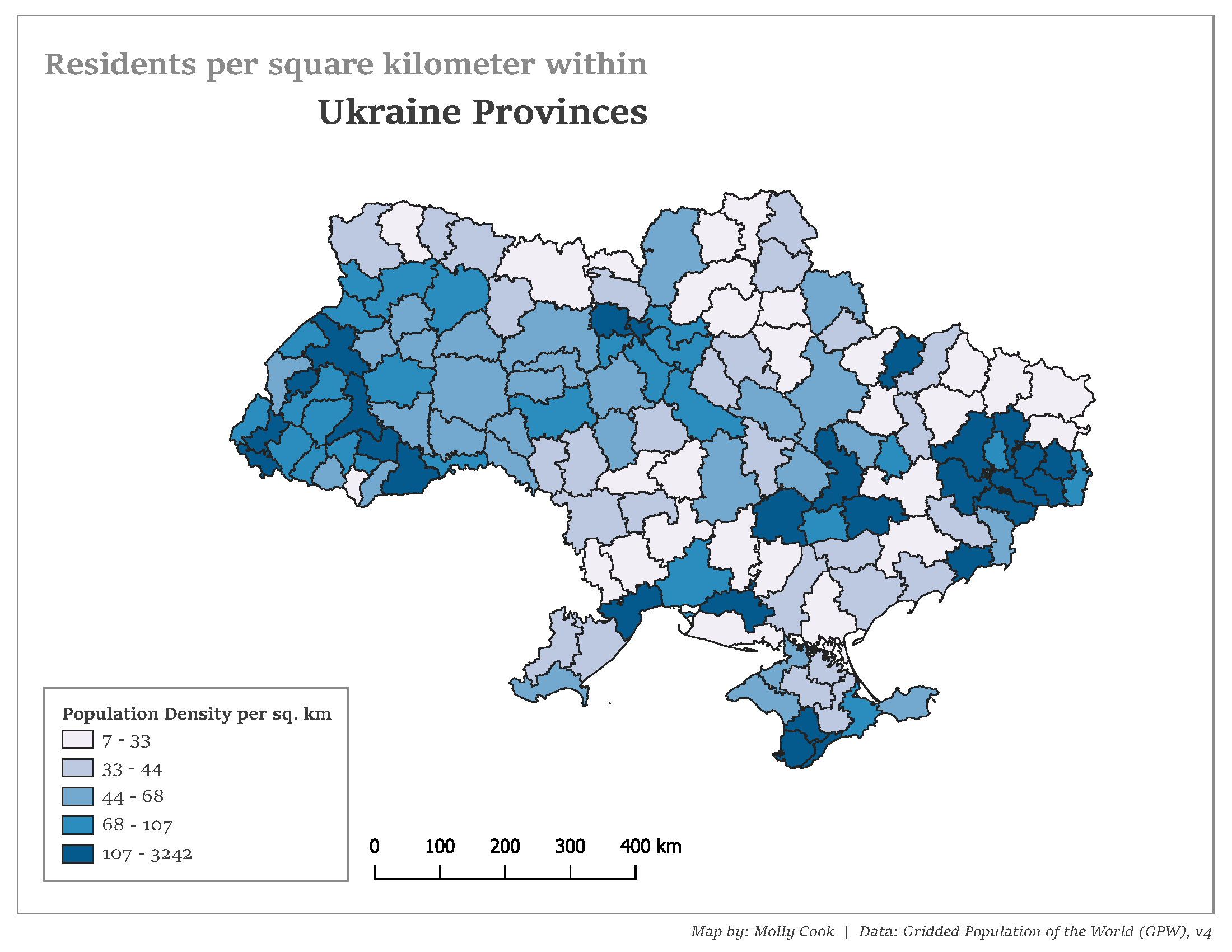
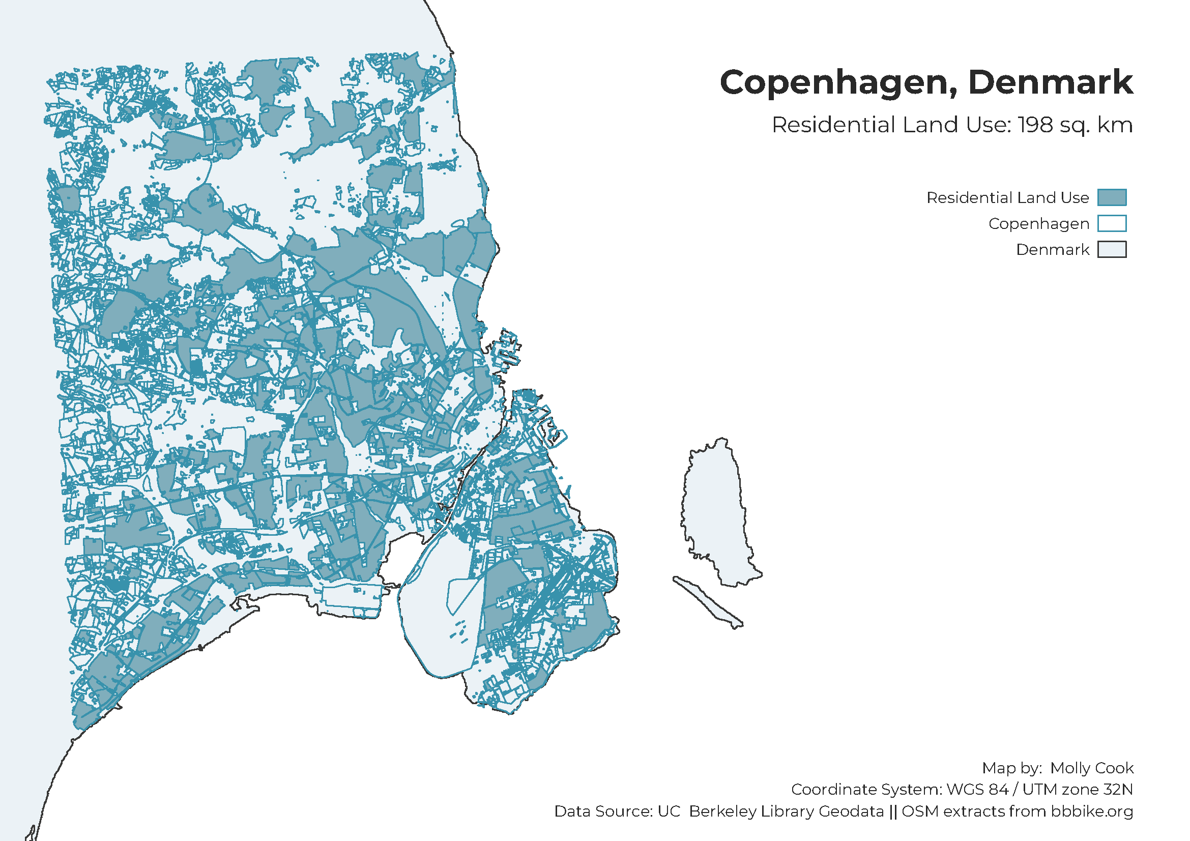
Geographical Information Systems | Thematic Maps
This collection features thematic maps created in QGIS, focusing on spatial analysis to assess exposure, vulnerability, or land use. Each map underwent detailed analysis to evaluate various aspects related to these themes.
What I Used
- QGIS
- Data Source: annotated within each document